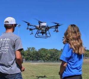
The career possibilities with unmanned aircraft systems (UAS) are wide-reaching, and these were on display at LLCC’s SkySoar Fest Sept. 15. The event was organized by the college’s Computer Science Academy (CSA).

Computer science
Drones are used in aerial photography and videography, search and rescue, law enforcement, delivery and logistics, environmental monitoring, journalism and more. “The technology continues to evolve, and new applications are constantly emerging as industries find innovative ways to leverage the capabilities of drones,” explains Dr. Carmen Allen, professor of computer science and CSA advisor.
“My initial interest was in flying drones for fun and sharing the experience with family and friends,” says Dr. Allen. “The more I learn, the more I understand their potential to provide supplemental income or full-time salaries for people of all ages.” Drones can collect data for 2D and 3D customized maps as well as provide live or recorded video views. “That kind of technology piques the interest of students because it combines the control of flying a robot with using a camera and video processing,” says Allen.
“This translates easily into the work of a computer science student who controls computers to process desired digital results.” Last May, Brandon Sharp, an LLCC computer science graduate, added a four-course geographic information system (GIS) certificate to his education, leading to awards and a fellowship.
Geographic Information Systems (GIS)
“GIS software is a tool that can be used to plan the route of a drone and to analyze the output from a drone,” says Rey de Castro, LLCC adjunct instructor, geography. Drones are able to capture high-resolution images, collect a 3D point cloud and provide accurate positioning. They can also access remote areas that are difficult to reach. “Surveying and volcanology provide good examples. Volcanologists use drones to track lava flows and monitor changes in the shape of volcanic vents. With drones, less time has to be spent collecting field data, particularly in such areas that are difficult and dangerous to access,” explains de Castro. “Survey work can include data for rail track inspections; a power line point cloud, which collects millions of point data to generate 3D models; and bridges. Without drones, bridge inspections require a large crew using ropes and harnesses to ensure safety and may require road closures. In contrast, drone inspection often involves just two people.
Agriculture
LLCC Agriculture uses drones at its land lab and in many classes for hands-on training. “In scouting we use a drone to identify areas of the field for further investigation,” explains Rich Teeter, professor of agribusiness management. “Many times, we pick up things from the air that we would not notice on the ground. Combine that with some normalized difference vegetation index (NDVI) images, and we can get a great representation of crop health to determine next steps for maximizing yield potential.” An exciting addition to LLCC Ag’s fleet of drones is the ag spraying/spreading drone (photo at right).
“We have used it to spread fertilizer on our corn and to apply micronutrients, fungicides, herbicides and insecticides,” says Teeter. “We also used it to seed cover crops over our standing soybean crop to give them a head start. If we had waited until harvest, it would be too late for some of our mixes to get established.”
LLCC Ag already has graduates using drones in the fertilizer industry and on their own farms. “One student has started a business specifically for drone spraying,” adds Teeter. “Drones can be used in monitoring livestock, seeding crops, checking plant health and analyzing crop performance and treatments. Drone technology is ever-evolving just like ag. Who knows what the future will hold.”
UAS training
The college also offers UAS remote pilot test prep and basic hands-on flight training courses through LLCC Continuing, Corporate and Professional Education. This introductory course prepares individuals for the Federal Aviation Administration Small Unmanned Aircraft System (sUAS) Remote Pilot Knowledge Exam. The hands-on flight training includes indoor and outdoor sessions. The goal of the outdoor phase is to allow students to receive as much flight experience as possible and progressively introduce more advanced flight maneuvers.
